Fraunhofer Institute for High-Speed Dynamics, Ernst-Mach-Institut, EMI
Satellite constellations are essential for independent capabilities in Earth Observation, communication and navigation. Germany has some catching up to do – but Fraunhofer is driving the development of a powerful European infrastructure with innovative research and strong partners.

Large satellite constellations are the key to a sovereign German and European space infrastructure
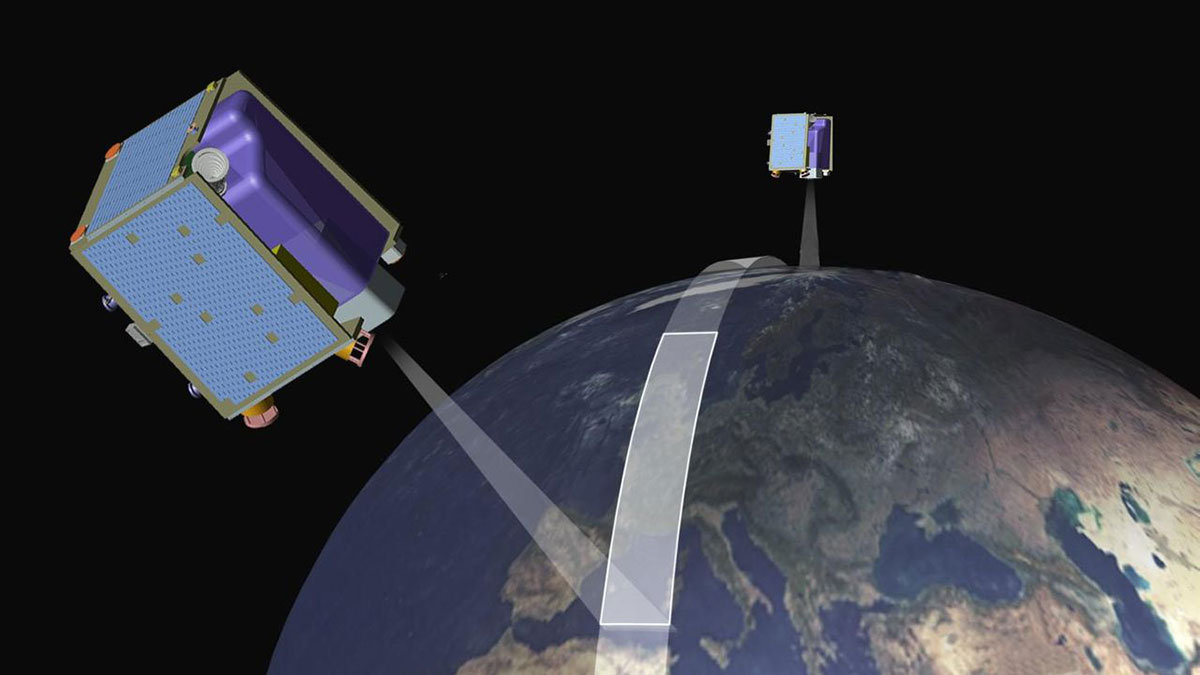
A satellite constellation is a group of artificial satellites that work together as a system and complement each other. Mega-constellations consist of hundreds to thousands of satellites and provide global coverage with minimal disruption, especially for Earth observation, communications and navigation.
RapidEye was the first German commercial satellite constellation consisting of five Earth observation satellites. On August 29, 2008, the five cube-shaped microsatellites, each weighing 156 kg and with an edge length of one meter, were launched from Baikonur, Kazakhstan, into a sun-synchronous orbit of 630 km by a Dnepr rocket. On board was an optical instrument for Earth observation containing five push broom scanning cameras, each with 12,000 pixels. This instrument was able to record multispectral images of the Earth’s surface in five wavelength ranges between 440 nm (blue) and 850 nm (near infrared). The optical system was able to achieve a geometric resolution on the ground of 6.5 meters per pixel. The swath width amounted to 77 km and the maximum length of the recorded image strip was 1500 km. The five satellites allowed to record every point on Earth every day.
The Canadian company MDA was the main contractor for the RapidEye system, commissioned by the company RapidEye AG in Brandenburg. The company SSTL in Guildford, UK, designed and manufactured the satellite bus, and the German company Jena-Optronik GmbH in Jena developed and manufactured the optical instrument, including line scan cameras.
At the time of RapidEye’s launch, there was no privately operated Earth observation constellation in the world. RapidEye AG was therefore a pioneer with the first commercial Earth observation satellite constellation. It delivered outstanding image quality and ground resolution for the time. At the same time, the company had to take high economic risks, as the market for geodata services was not yet well developed and the digitization of companies and authorities was often still in its infancy.
RapidEye AG’s business model, which consisted of selling high-resolution optical Earth observation images, unfortunately did not last long. The joint decision taken in 1998 by the European Commission and the European Space Agency ESA to implement a major Earth observation program called Copernicus proved to be particularly problematic for the company. The aim of this program was to create an independent European Observation system that has been in operation since the launch of the first Sentinel satellite in 2014 and, among other things, provides high-resolution image data similar to that of RapidEye – but makes it available to users worldwide free of charge. The company RapidEye AG, which initially had clear unique selling points with its services, was sold in 2011 to Planet Labs Germany in Berlin, a spin-off of the US company Planet Labs, which continued to operate the constellation until 2020.